Volunteer ‘saved’ from North Sea in live Galileo rescue test
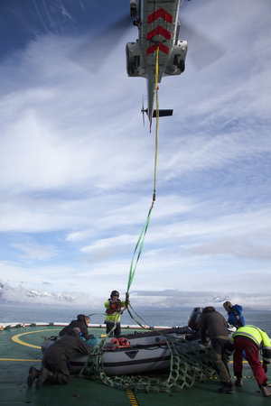
Europe’s Galileo constellation is doing more than providing global navigation services, it is also saving lives. As a real life demonstration of Galileo’s search and rescue capability, a volunteer was cast away in a lifeboat off the Belgian coast, then activated an emergency beacon for rescue.
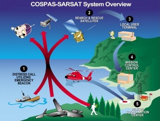
The following steps were automatic: the signal from the beacon was detected by the search and rescue payload aboard multiple Galileo satellites orbiting above our heads, which pinpointed its source on Earth’s surface.
Next, this the data was relayed to a control centre located in the Toulouse centre of French space agency CNES, then passed to the nearest national rescue centre – Belgium’s Maritime Rescue Coordination Centre, based in Oostende harbour. In the event, this detection, localisation and notification process took just three minutes 32 seconds, at which point the rescue began.
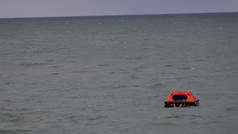
The 26 September test was dubbed ‘Operation Shark Bait’. The volunteer was TV producer and ESA SocialSpace fan Tara Foster – followable on Twitter as ‘@Taraustralis’ – sitting inside her inflatable raft: “You can feel the waves under you just like sitting in a waterbed, and you’re wondering how long you’ve been out there because you don’t know.”
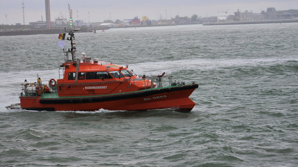
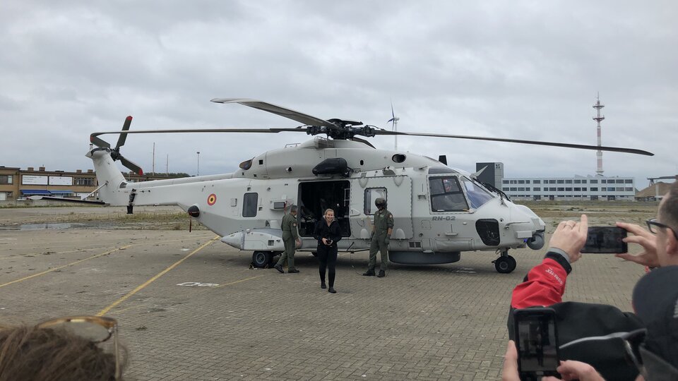
Belgian Coast Guard boat Orka R6 dashed out to sea, guided by a positioning precision of less than 2 km, joined by an NH90 Caiman helicopter – because in the test scenario the patient had been burned, and required medical evacuation to hospital. So once Tara was taken aboard the ship she was then winched aboard the helicopter.
The search and rescue payloads aboard Galileo represent a significant evolution of Cospas-Sarsat, the international satellite-based locating system founded by Canada, France, Russia and the US in 1979.
Cospas–Sarsat began with payloads on low-orbiting satellites, whose rapid orbital motion allowed Doppler ranging of distress signals, to pinpoint their source. The drawback is that they fly so close to Earth that their field of view is comparatively small.
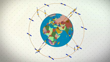
Geostationary satellites see much more of Earth, but because they are motionless relative to the surface, Doppler ranging is not possible. Medium-orbiting satellites like Galileo at 23 222 km altitude offer the best of both worlds – a wide view combined with Doppler ranging to localise SOS signals.
Some 24 out of 26 Galileo satellites in orbit around Earth carry a Search and Rescue payload, as part of Europe’s contribution to Cospas-Sarsat. This enlarged coverage improves the maximum signal detection time from four hours to less than five minutes, down to a few kilometres (within a formal specification of 5 km within 10 minutes).
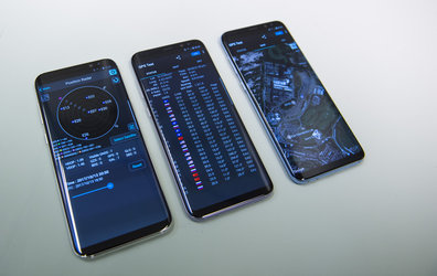
This position accuracy is of course orders of magnitude lower than Galileo’s navigation service, which operates at much higher power, is stabilised by an atomic clock that is precise to a scale of nanoseconds and uses 25 000 times more bandwidth.
The Cospas-Sarsat system is instead designed to work independently of satellite navigation, because the vast majority of rescue beacons are not equipped with satnav – although satnav fixes are also available from the latest generation of equipment.
Instead Cospas-Sarsat employs a combination of signal travel time and Doppler ranging to pinpoint signal sources, providing good enough precision for emergency rescue while keeping the size, power and cost of their beacons at workable levels.
“Galileo’s Search and Rescue service has already saved more than 2000 lives by extending Cospas-Sarsat’s detection of distress signals into medium-Earth orbit,” explains ESA’s Galileo SAR engineer Igor Stojkovic.
The satellite packages are supplemented by a trio of ground stations at the edges of Europe, known as Medium-Earth Orbit Local User Terminals (MEOLUT), based in France, Norway, Cyprus and Spain’s Canary Islands, along with other regional ground stations worldwide. The satellites relay distress messages to these MEOLUTs, which then relay them to local search and rescue authorities.
Galileo is the European Global Satellite Navigation System, operated by the European GNSS Agency, designed and developed by ESA and managed by the European Commission.