AI maps icebergs 10,000 times faster than humans
In a groundbreaking development, researchers from the University of Leeds have unveiled a neural network that can swiftly and accurately chart the expanse of large Antarctic icebergs in satellite images, accomplishing the task in a mere 0.01 seconds. This novel approach is in stark contrast to the laborious and time-consuming manual efforts needed previously.
Anne Braakmann-Folgmann, lead author of the findings published today in The Cryosphere, conducted her research during her tenure as a PhD student at the University of Leeds in the UK. Now working at the Arctic University of Norway in Tromsø, she emphasised the significance of large icebergs in the Antarctic environment.
“Giant icebergs are important components of the Antarctic environment. They impact ocean physics, chemistry, biology and, of course, maritime operations. Therefore, it is crucial to locate icebergs and monitor their extent, to quantify how much meltwater they release into the ocean.”
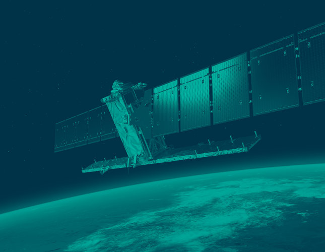
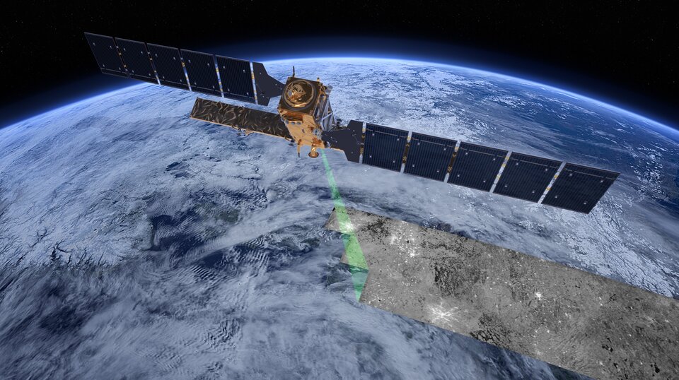
Providing images of icebergs regardless of cloud cover and lack of daylight, the Copernicus Sentinel-1 radar mission plays a pivotal role in the innovative approach of using Artificial Intelligence to map bergs.
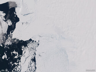
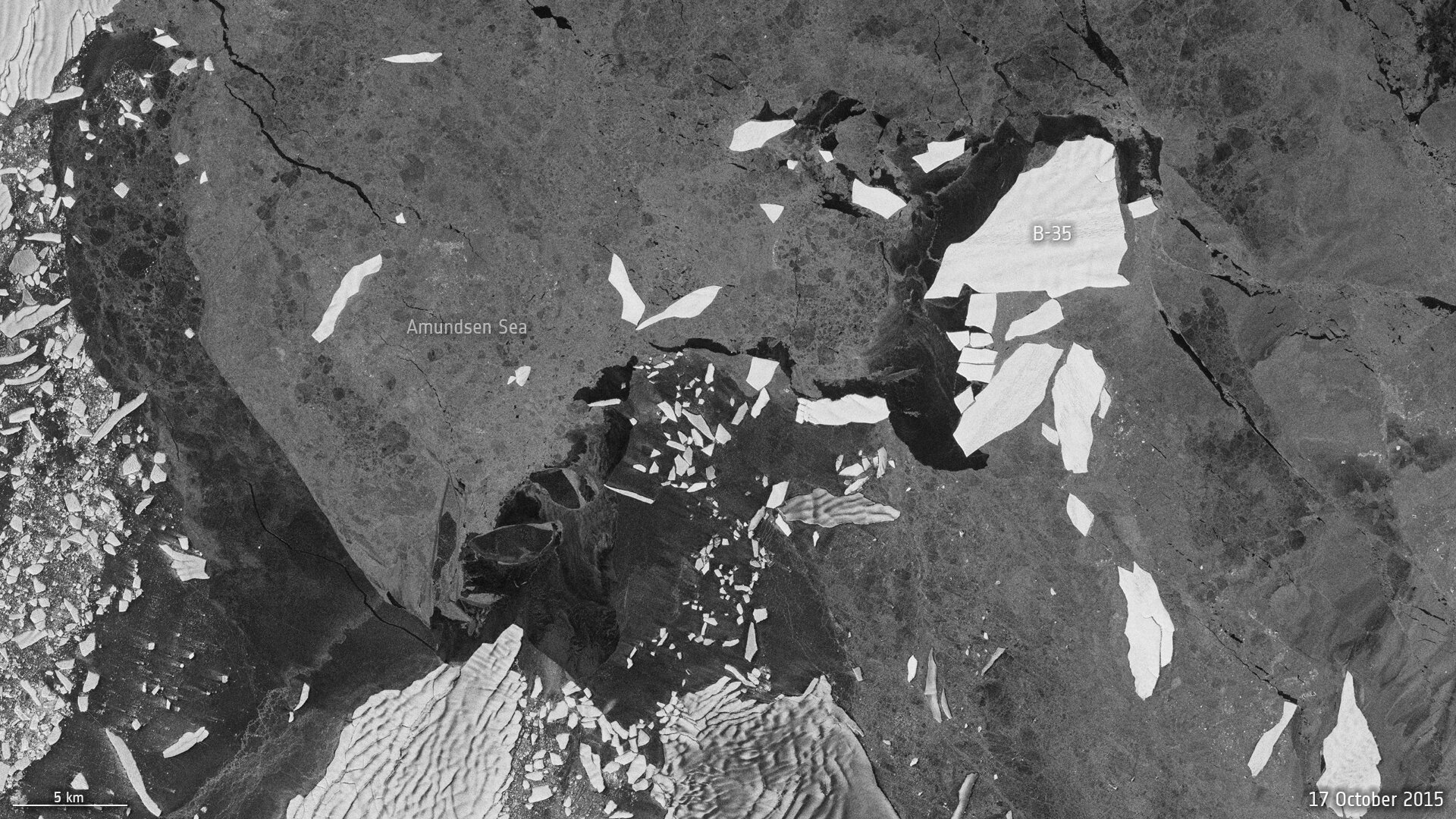
In images from satellites carrying camera-like instruments, icebergs, sea ice and clouds all appear white, making it hard to pick out actual icebergs.
Whereas in most radar images, as returned by Sentinel-1, icebergs appear as bright objects against the darker ocean and sea-ice background.
Nevertheless, when the surroundings are complex, it can still sometimes be difficult to differentiate icebergs from sea ice or even the from the coastline.
Dr Braakmann-Folgmann, explained, “We have sometimes struggled to separate icebergs from surrounding sea ice that is rougher and older, and therefore looks brighter in the satellite images. The same applies to wind-roughened ocean.
“Also, smaller iceberg fragments, which occur frequently near icebergs as they constantly lose bits of ice around their edges, are easily grouped together with the main iceberg by mistake.
“In addition, the Antarctic coastline may resemble icebergs in the satellite images, so standard segmentation algorithms often select the coast too instead of just the actual iceberg.”
The new neural network approach, however, excels in mapping iceberg extent even in these challenging conditions. Its power lies in the neural networks' ability to understand intricate non-linear relationships and take the whole image context into account.
To effectively track changes in iceberg area and thickness, essential for understanding how icebergs dissolve and release freshwater and nutrients into the ocean, pinpointing a specific giant iceberg for continuous monitoring is crucial.
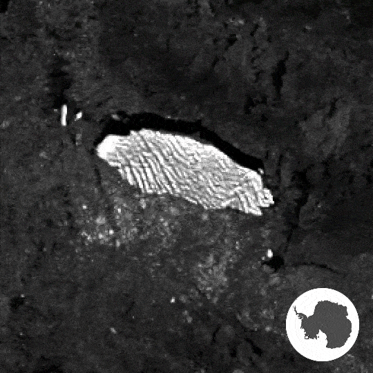
The neural network introduced in this study is highly proficient in identifying the largest iceberg in each image, unlike comparative methods, which frequently select slightly smaller icebergs in proximity.
The architecture of the neural network is based on the renowned U-net design. It was meticulously trained using Sentinel-1 images exhibiting giant icebergs in various settings, with manually-derived outlines serving as the target.
Throughout the training process, the system continually refines its predictions, adjusting its parameters based on the difference between the manually derived outline and the predicted result. Training ceases automatically when the system reaches its optimum performance, ensuring its adaptability and success on new examples.
The algorithm has been tested on seven icebergs, ranging in size from 54 sq km to 1052 sq km, roughly equivalent to the areas of the city of Bern in Switzerland and Hong Kong, respectively.
A diverse dataset was compiled, incorporating between 15 and 46 images for each iceberg, spanning various seasons and the years 2014 –2020.
A single Sentinel-1 image per month per iceberg was used to ensure dataset variety. Presenting an accuracy of 99%, the results have been impressive.
Dr Braakmann-Folgmann added, “Being able to map iceberg extent automatically with enhanced speed and accuracy will enable us to observe changes in iceberg area for several giant icebergs more easily and paves the way for an operational application.”
ESA’s Mark Drinkwater noted, “Satellites are, of course, essential for monitoring changes and understanding processes occurring far from civilisation. This new neural network automates what would otherwise be a manual and labour-intensive task of locating and reporting iceberg extent.
“We congratulate the team on the introduction of this innovative machine learning approach, to achieve a robust and accurate approach to monitoring changes in the vulnerable Antarctic region.”