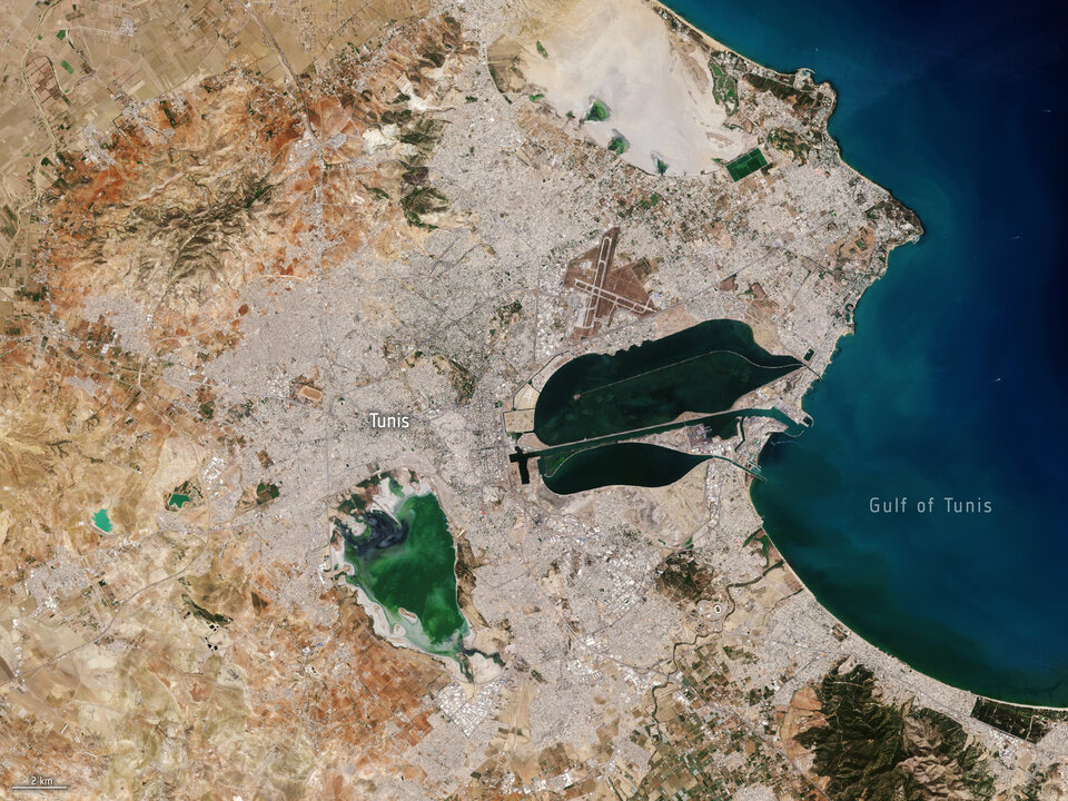
From space to soil
Soil sealing might not be a term that everyone's familiar with, but its effects are felt far and wide, particularly in urban areas.
Recognising the urgencies of addressing soil sealing and its associated challenges, an ESA-funded project, Ulysses, is offering insights into the extent and severity of soil sealing to mitigate soil degradation in the Mediterranean region.
Soil sealing refers to the process whereby soil surfaces are covered by impermeable materials such as concrete, asphalt or buildings, preventing water from infiltrating into the ground. This usually occurs in urban and industrial areas because of construction, car parks and other forms of development.
When soil is sealed, it loses its ability to absorb rainwater, leading to increased surface runoff and reduced groundwater recharge. This can contribute to various environmental problems, including flooding, soil erosion, loss of biodiversity and decreased soil fertility. Soil sealing also exacerbates the urban heat island effect by reducing the cooling effect of soil evaporation and vegetation.
Soil sealing monitoring is crucial, particularly for Mediterranean coastal areas, where soil degradation, combined with drought periods and fires, contributes to desertification risk.
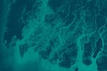
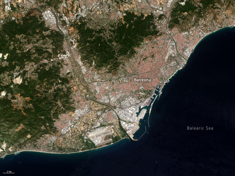
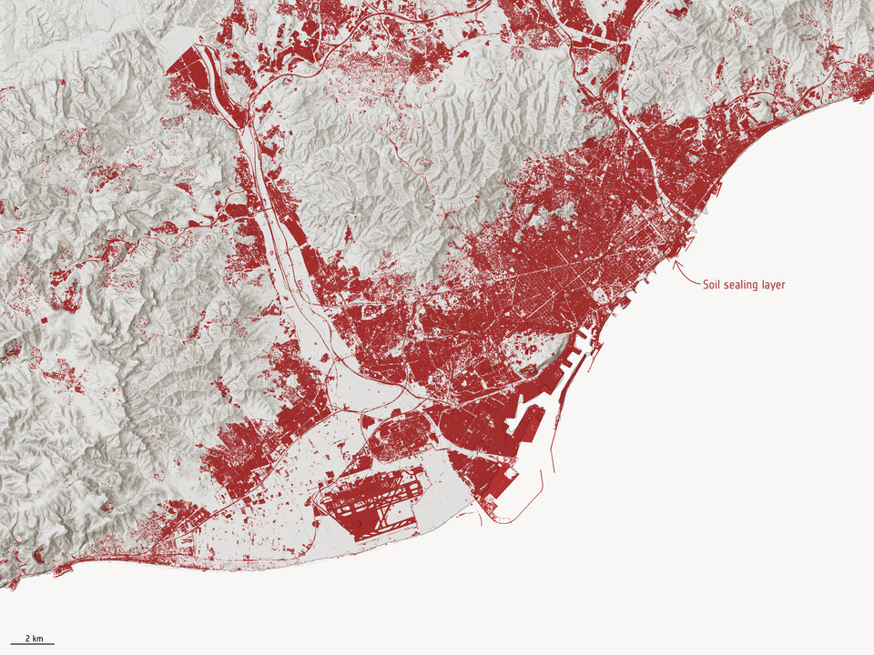
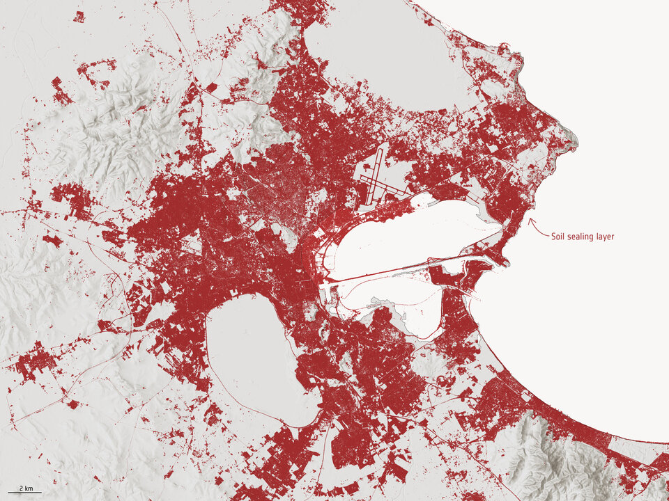
That’s where the Ulysses project, or ESA Mediterranean Initiative, comes in. The project utilises Copernicus Sentinel-2 data to generate detailed maps depicting the extent and severity of soil sealing across the entire coastline of the Mediterranean Sea – enabling researchers to meticulously track changes in soil composition and permeability over time.
Open Image
The team, led by Planetek Italia and supported by Collecte Localisation Satellites (CLS) and the Italian Institute for Environmental Protection and Research (ISPRA), have generated maps spanning the 2018-2022 period.
The maps have allowed for the quantification and monitoring of soil sealing over the Mediterranean basin, supporting users and stakeholders involved in monitoring and preventing land degradation.
Daniela Iasillo, Ulysses Project Manager at Planetek, commented, “With a resolution of 10 m, the maps of a level of precision that was previously unattainable, allowing stakeholders to pinpoint areas most in need of intervention and formulate targeted strategies for conservation and restoration.”
Central to the project is the active involvement of end-users in this research project, led by ISPRA. With its extensive network and deep-rooted connections within the realm of land degradation and environmental conservation, ISPRA serves as a bridge between the project's findings and the individuals and organisations tasked with implementing them on the ground.
By ensuring that the project's outputs are relevant, accessible, and actionable, ISPRA plays a pivotal role in translating scientific insights into tangible outcomes.
Open Image
Luca Congedo, from ISPRA said, “The availability of soil sealing maps, frequently updated with a methodology providing homogeneous results across the Mediterranean coast, allows for the calculation of fundamental indicators that can be used in international initiatives related to environment monitoring, and foster soil protection policies.”
The project fits perfectly with the proposed EU Soil Monitoring Law which aims to protect and restore soils to ensure they are used sustainably. The law aims to address key soil threats in the EU, such as erosion, floods, landslides, sealing, as well as the loss of soil biodiversity.
It also aligns with France’s Zero Net Artificialisation law, which intends to limit the expansion of built areas by 2050 and halve the consumption of natural, agricultural and forest areas over the next ten years.
ESA’s Olivier Arino, commented, “ESA initiatives like the Ulysses project, are essential in supporting policymakers for their activities related to coastal zone management and allows us to better address the resilience of Mediterranean basin to climate change.”
Over the next six months, ESA will extend the scope of this mapping efforts from the coastal regions to encompass the entirety of the involved member states — specifically Spain, France, Italy and Greece.