Surpassing expectations
Although CryoSat was developed to measure the changes in the thickness of polar sea ice, the elevation of the ice sheets and mountain glaciers, the mission has gone above and beyond its original objectives.
The satellite’s radar altimeter not only detects tiny variations in the height of the ice, it also measures sea level and the sea ice’s height above water to derive sea-ice thickness with an unprecedented accuracy.
At a higher precision than previous altimeters, CryoSat’s measurements of sea level are improving the quality of the model forecasts. Small, local phenomena in the ocean surface like eddies can be detected and analysed.
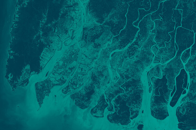
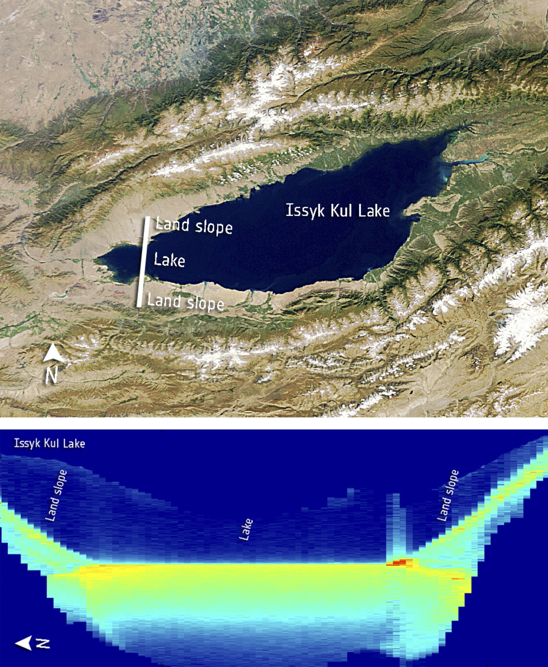
Taking CryoSat a step further, scientists discovered that the altimetry readings have the potential to map sea level closer to the coast, and even greater capabilities to profile land surfaces and inland water targets such as small lakes, rivers and their intricate tributaries.
Radar altimeters have more difficulty doing this because, compared to open ocean measurements, the landscape surrounding inland water bodies is a lot more complex. But CryoSat’s ground-track resolution of about 300 m enables it to detect subtle differences in the topography around small landforms.
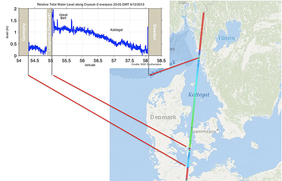
In December 2013, CryoSat measured the storm surge in the North Sea as high waters passed through the Kattegat sea between Denmark and Sweden. The measurements were used to validate storm surge models, but also demonstrated the potential of radar altimeters to provide near-realtime information that can be used for storm surge forecasting.
The mission’s measurements of sea-level incidentally also map the topography of the ocean floor and the global marine gravity field.
The topography of the ocean surface mimics the rises and dips of the ocean floor due to the gravitational pull. While gravity missions, such as ESA’s former GOCE satellite, provide extraordinarily accurate measurements of gravity at the spatial resolution of hundreds of kilometres, CryoSat’s sensing of the gravity field at the ocean surface reveal seafloor characteristics at scales of 5–10 km.