
Earth from Space: Airplanes and volcanic ash
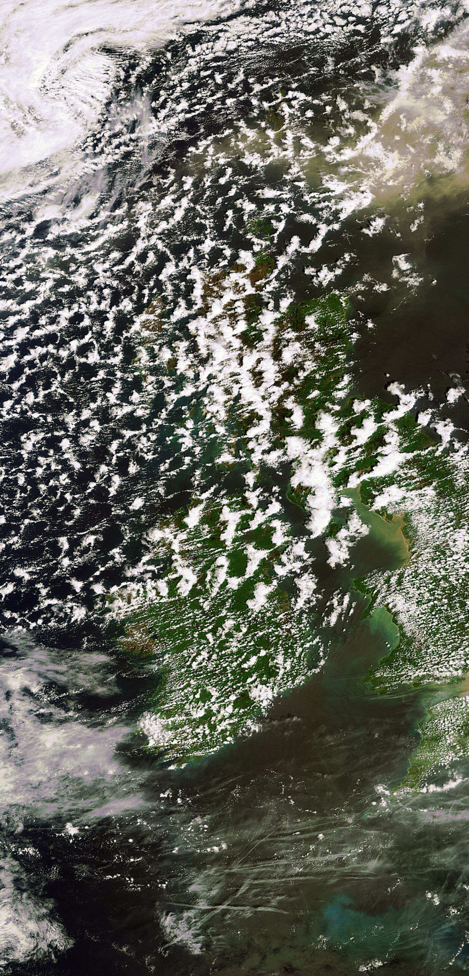
This Envisat image shows a large cloud of ash north-east of Scotland that has been carried by winds from Iceland’s Grímsvötn volcano about 1000 km away.
The Grímsvötn volcano, located in southeast Iceland about 200 km east of Reykjavik, began erupting on 21 May for the first time since 2004.
Despite being larger than the Eyjafjallajoekull eruption that reeked havoc on air traffic last year, the Grímsvötn eruption is not expected to be as impactful.
Still as winds pushed the ash cloud toward the UK, major airline carriers grounded flights on Wednesday that were due to fly in and out of Scotland and Ireland.
Volcanic eruptions eject large amounts of ash and trace gases such as sulphur dioxide into the atmosphere, often reaching the altitudes of scheduled flights.
When flying through a volcanic ash cloud, ash particles enter the jet engines and can result in engine failure. The ash can also severely damage the material of the aircraft.
Ensuring these hazards are addressed, the Volcanic Ash Advisory Centres (VAACs) were established in 1995 to gather information regarding volcanic ash clouds and to assess the possible hazard to aviation.
Satellite measurements offer an excellent means to follow the spread, extension, concentration and movement of volcanic plumes. To this end, ESA has developed dedicated services to provide fast alerts on volcanic eruptions to support VAACs within the Support to Aviation Control Service project.
Interestingly, numerous aircraft condensation trails, or 'contrails', are visible south of Ireland, about 800 km south of the ash cloud. Exhaust emissions from jet aircraft contain large amounts of water vapour, which, under certain atmospheric states, will condense to form ice crystals.
These act as condensation nuclei around which even more water vapour in the surrounding air condenses. The end result is the formation of an elongated cloud-like condensation trail in the sky.
This image was acquired on 24 May by Envisat’s Medium Resolution Imaging Spectrometer at a resolution of 300 m.

