
Earth from Space: Canada’s James Bay
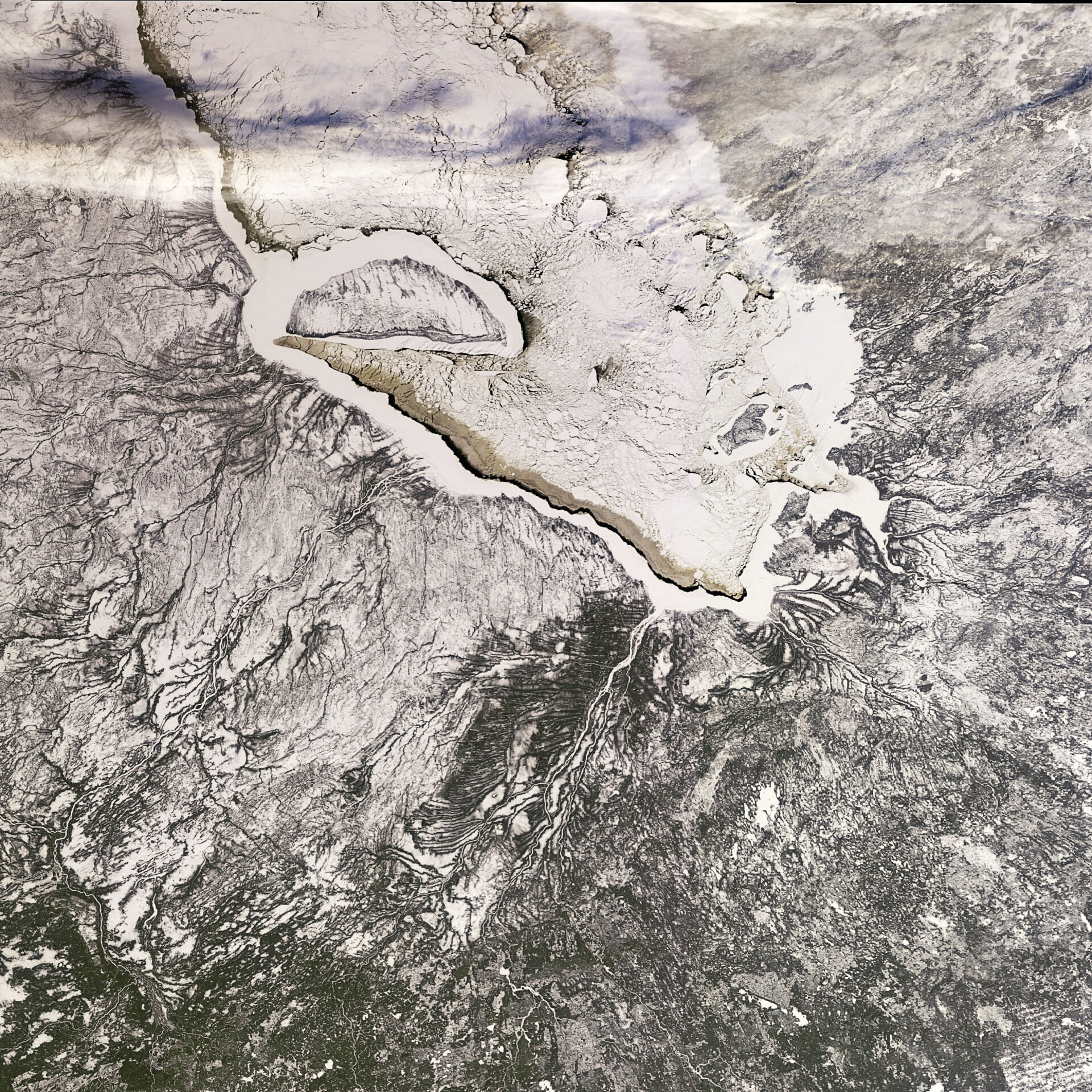
This Envisat image features an ice-covered James Bay in Canada’s Nunavut territory, with the provinces of Quebec (right) and Ontario (left) visible.
James Bay – the southern inlet of Hudson Bay – contains numerous islands including the crescent-shaped Akimiski Island (visible in the upper left). Akimiski, the bay’s largest island, is a coastal wetland that serves as the home for numerous varieties of migratory birds.
Wetlands, areas that are covered with water for long enough periods to support plants that thrive in wet soils, contribute to our lives in remarkable ways yet they are experiencing loss and degradation on a massive scale.
Countering their loss requires baseline information on wetland resources and effective monitoring programmes, but because they are often made up of complex and impenetrable terrain monitoring them is very difficult.
ESA’s GlobWetland project, carried out from 2003 to 2008, demonstrated how satellite data can support the inventorying, monitoring and assessing of wetland ecosystems. Based on the project’s success, ESA has initiated a follow-on GlobWetland project for 2009.
The two islands visible as round white holes some 50 km northeast of Akimiski Island are the Twin Islands, which contain small lakes and marshland and are important breeding grounds for a number of bird species. The large island visible at the very southern end of the bay is Charlton Island.
This image was acquired by Envisat’s Medium Resolution Imaging Spectrometer (MERIS) instrument on 6 January 2009 working in Full Resolution mode to provide a spatial resolution of 300 metres.

