
Earth from Space: Europe’s largest port
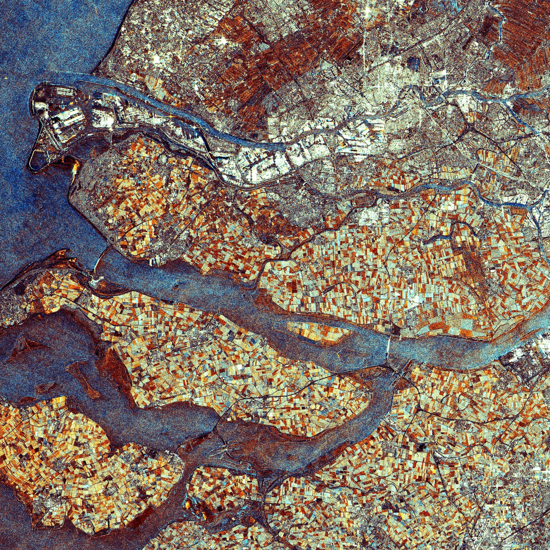
The port of Rotterdam and the province of Zeeland, both located in the southwest of the Netherlands, are highlighted in this Envisat image.
Rotterdam port (visible on left a quarter of the way down from top) is the largest port in Europe and the gateway to some 450 million consumers. The port, located on the North Sea, area stretches over 40 km in length and covers 10 000 hectares. It has a depth of 24 m.
Rotterdam, the country’s second largest city after Amsterdam, is located on the New Meuse River, formed by the Rhine and Meuse rivers, that divides the municipality into its northern and southern parts. The city centre is situated on the northern bank (visible in light green).
The large body of water in the middle of the image beneath Rotterdam is Haringvliet. Haringvliet dam, which took 14 years to complete, is visible as a brownish bridge closing the mouth of the river off from the North Sea. Its 17 openings allow it to regulate the amount of water flowing to the sea.
The dam was constructed as part of the ‘Delta Plan’ – a number of dams, sluices, locks, dikes and storm surge barriers built between 1950 and 1997 in the southwest of the Netherlands to reduce the length of and reinforce the coastline.
In 1953, a tidal wave broke the existing dikes and flooded the area, killing nearly 2000 people and 50 000 heads of cattle. The ‘Delta Plan’ was inaugurated twenty days after the flood. Volkerak dam, also part of the plan, is visible in the image at the eastern end of Haringvliet.
The third body of land (lower left hand corner) is part of the province of Zeeland, a large river delta that mostly lies below sea level.
This image was acquired by Envisat’s Advanced Synthetic Aperture Radar (ASAR) instrument in Image mode with a resolution of 12.5 m.

