Satellites map aftermath of Emilia-Romagna floods
The Italian region of Emilia-Romagna was devastated by severe floods in May 2023, claiming lives and displacing thousands of people, resulting in an estimated €8.8 billion in damages. With the region still grappling with the aftermath, satellites have been instrumental in assessing the damages of the affected areas.
Between 16-18 May 2023, 350 million cubic metres of water, equivalent to six months’ worth of rain, fell within 36 hours across Emilia-Romagna, one of Italy’s most important agricultural regions. The heavy rain led to the overflow of 23 rivers across the region, affecting 100 municipalities and triggering more than 400 landslides, which in turn damaged and closed off hundreds of roads.
The floods were preceded by a drought that dried out the land, reducing its capacity to absorb water.
Earth observation imagery and data are crucial for emergency services, as they provide the ability to assess potential impacts of natural disasters and assist in emergency management activities, but they can also support post-event analysis and damage assessment.

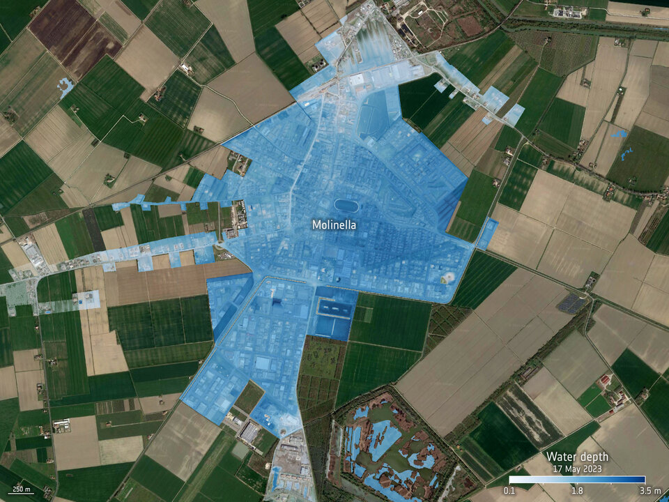
The SaferPlaces platform, co-funded by the ESA InCubed programme, has been utilised by the Civil Protection of the Emilia-Romagna region to generate flood water and depth maps to take crucial decisions after the disaster and support the assessment of the damages of the affected areas. The platform utilises satellite, climate data and AI-based models combined into a cloud computing environment to provide insights into areas prone to floods across the globe.
SaferPlaces’ AI-based algorithms were used to process terrain data and information on the flooded areas obtained by merging in situ data with multiple satellite sources including: Copernicus Sentinel-1 and Sentinel-2, CosmoSky-Med, Planet and SPOT.
Information on the flooded areas and the affected buildings conducted by local municipalities and data provided by the Emilia-Romagna Civil protection were also integrated to fill the gaps and increase the accuracy of urban flooded areas when not captured by satellites.
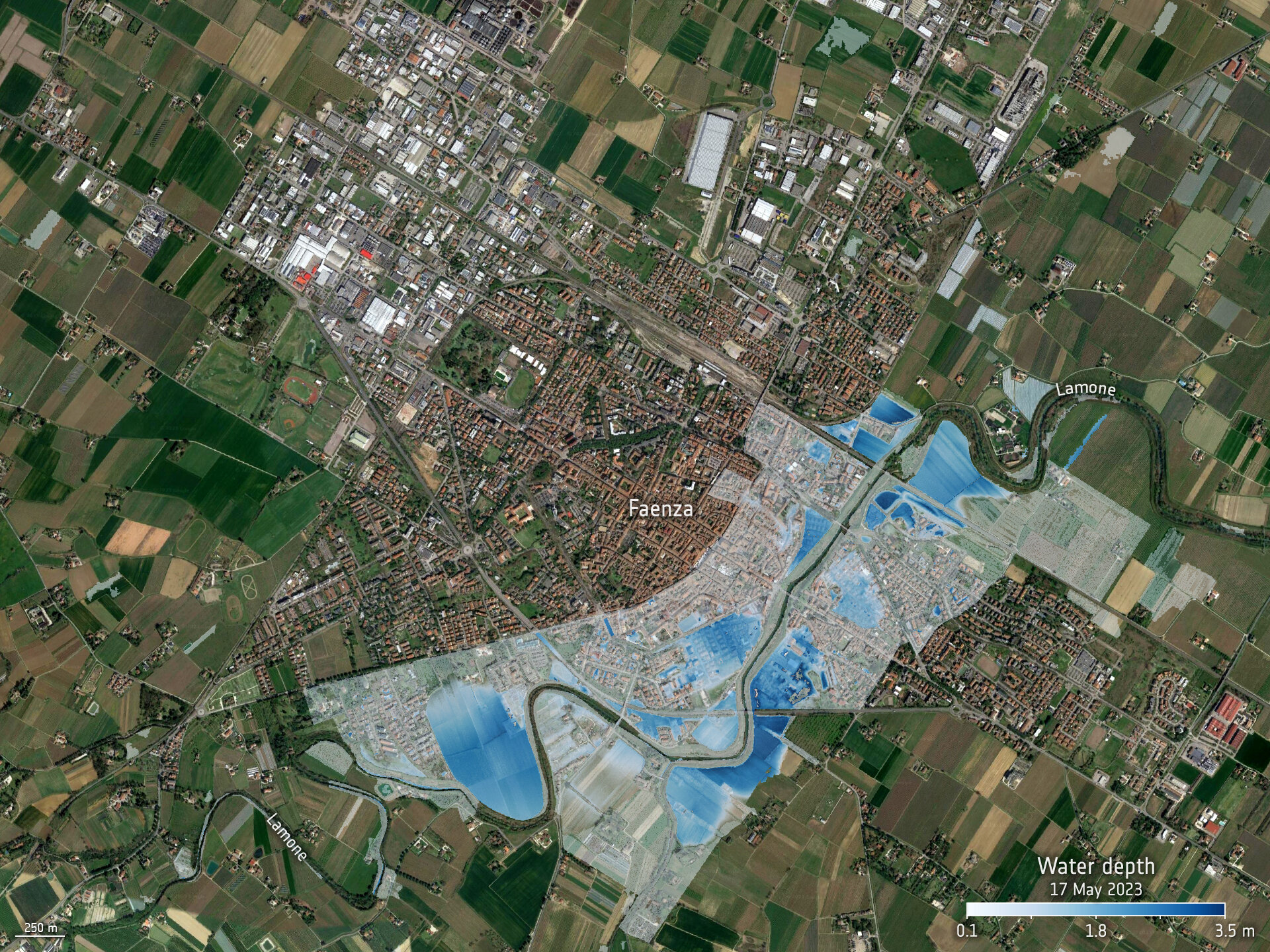
Maps portraying the extent of the flooded areas in the most affected municipalities, Faenza, Cesena, Forlì and Conselice, were generated with information on the depth and volume of the water.


Open Image
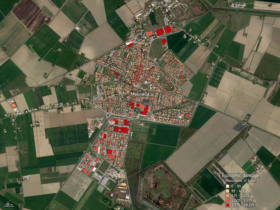
These maps provided crucial information for a preliminary Flood Damage Assessment to support the local and central authorities to estimate the damages as soon as possible. Specifically, the satellite-based water depth maps were used as input to assess the economic losses of affected buildings.
Claudia Vezzani, Technical Manager of the Hydraulic Risk Area of the Civil Protection Agency of Emilia-Romagna region, highlighted: "SaferPlaces technology and Earth observation data allow us to usefully support the disaster analyses and the computation of economic losses.”
SaferPlaces also compared the satellite-based flood masks with the maps produced by the Copernicus Emergency Management Service which had been activated to monitor the flood and landslide extent in the region. Radar data from Sentinel-1 and optical data from Sentinel-2 were combined with Cosmo-SkyMed, PAZ, SPOT and Pleiades data from 20-23 May 2023.
Stefano Bagli, the CEO of GECOSistema and SaferPlaces project manager underlined how, “The work done with the Civil Protection in Emilia-Romagna is a perfect example of exploiting the potential of the SaferPlaces platform and Earth observation satellite data to effectively support post-disaster evaluation and damage assessment analysis.”