
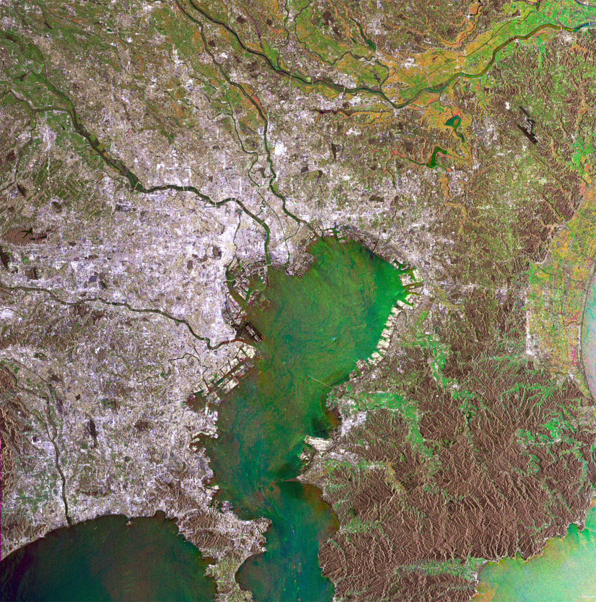
Tokyo, Japan
This Envisat radar image delineates the extent of Tokyo, the largest urban agglomeration in the world.
Defined at its narrowest the city of Tokyo has 8.1 million inhabitants, while the Tokyo prefecture amounts to 12.1 million. However what is called 'Greater Tokyo', stretching around Tokyo Bay, is home to a massive 33.4 million people, accounting for 26% of the entire Japanese population.
Unlike comparable mega-cities, the population of Tokyo is remaining broadly constant, the main development being a movement of people from its core to the margins, partly driven by exorbitant city centre rents. Finger-shaped extensions of development correspond to comparable land prices and commute times.
Tokyo's centre lies mainly south of the Ara-kawa River. Other visible rivers on this image are the Edo-gawa River to its north and the Tama-gawa River just to its south, all three rivers streaming into Tokyo Bay.
Spot the difference between the area northwest of Tokyo Bay, where the colours are predominantly grey and white - signs of dense construction - and its south-eastern opposite. With overall brownish colours is the site of the Minami Boso Quasi National Park, known for its beautiful beaches and wild flowers. Note the runways of Haneda Airport in the Bay, distinctively black in this radar image.
Another clearly visible example of modern infrastructure is the five-kilometre bridge of the Tokyo Wan Aqua-Line, the trans-Tokyo Bay highway, extending from the east side to seemingly vanish in the middle of the Bay. The remaining ten kilometres of road to the Kawasaki side is in a tunnel running 60 metres beneath the surface of the water. The Tokyo Wan Aqua-Line opened in December 1997 and provides easy access from the south part of the Bay to the Tokyo area.
Radar images measure surface roughness rather than reflected light. The colour in the image comes from the fact that this is actually a combination of three Envisat Advanced Synthetic Aperture Radar (ASAR) image mode precision images, and is used to highlight changes occurring between acquisitions. A colour is assigned to each date of acquisition: red for 12 April 2004, green for 17 June 2004 and blue for 2 February 2004.

