Applications
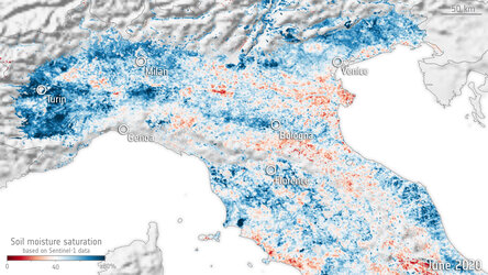
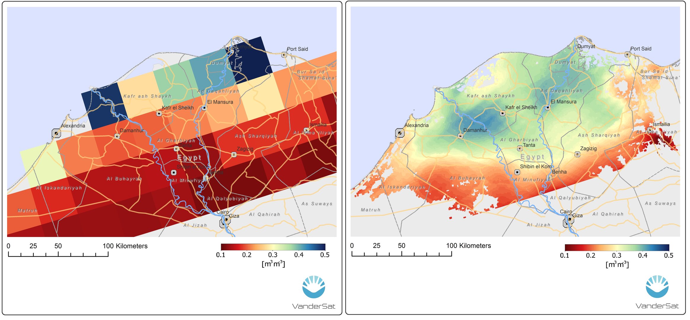
Zooming in on moisture
This shows that by combining measurements of soil moisture from different sensors, the spatial resolution is increased from 25 km x 25 km to 100 m x 100 m. In this case, data from SMAP and Sentinel-1 were used to create the high-resolution map of soil moisture around the Nile Delta in Egypt on 12 May 2016.
Read full story: SMOS on speed