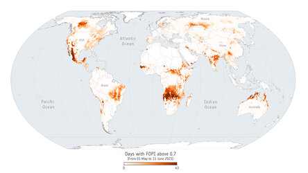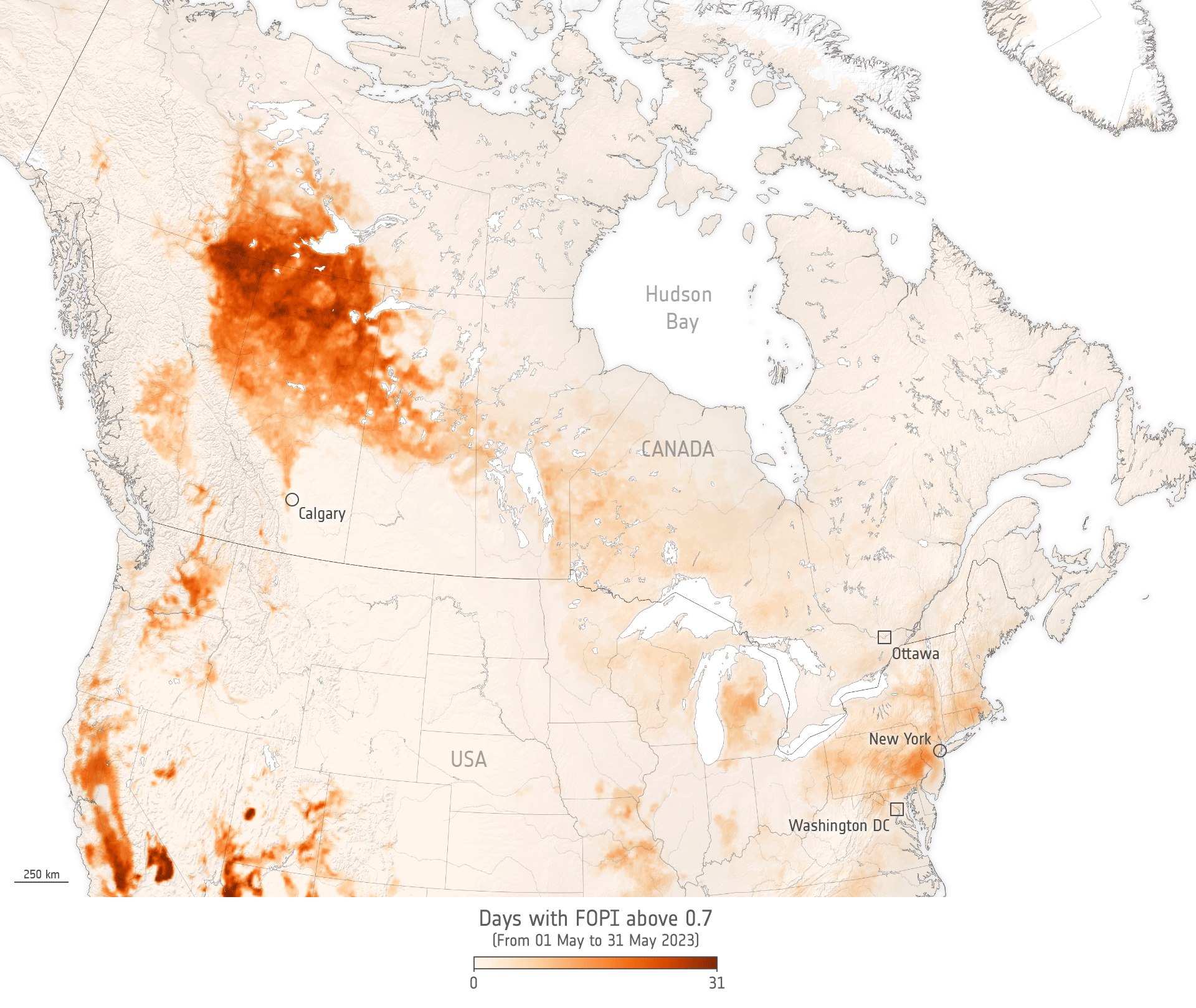
Fire probability over Canada and north USA for 1–31 May 2023
Recent wildfires have ravaged Canada, with hundreds of reported incidents. Many of these wildfires remain uncontained, revealing the limitations of existing suppression strategies when confronted with unprecedented conditions. The thick haze of smoke they produced blanketed cities as far as the USA. The newly-developed Fire Occurrence Probability Index (FOPI) aims to enhance fire danger predictions. It does this by combining the widely-used Canadian fire weather index with observations of Vegetation Optical Depth from ESA’s SMOS mission, serving as an indicator of fuel quantity and moisture.
The animation here first shows the number of days between 1 May and 31 May that the FOPI for Canada and the northern part of USA was over 0.7, and then fire hot spots using data from two MODIS satellite sensors. FOPI values range from 0 to 1; 0 being no danger, and 0.8 and above being extreme danger.
Read full story: Forecasting fires with SMOS