Sentinel-1 maps flash floods in Laos
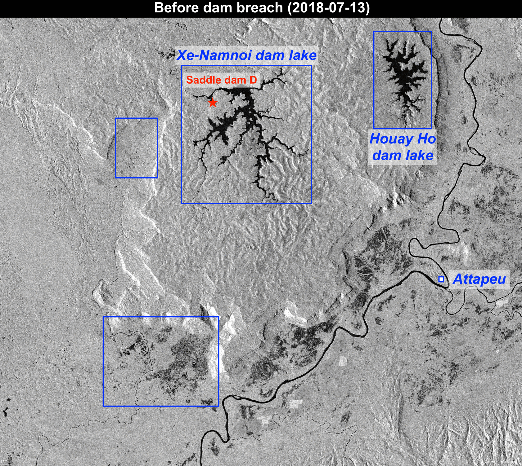
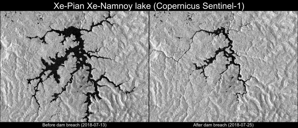
Copernicus Sentinel-1 data are highlighting the collapse of the Xe-Pian Xe-Namnoy dam in the southeastern province of Attapeu in Laos. The collapse has led to flash floods that have claimed several lives and left many more people missing, according to local news reports.
Sentinel-1’s radar ability to ‘see’ through clouds and rain, and in darkness, makes it particularly useful for monitoring floods. Images acquired before and after flooding offer immediate information on the extent of inundation and support assessments of property and environmental damage.
The C-band synthetic aperture radar on Sentinel-1 can provide large swath images with a resolution of 20 m and within hours of acquisition to aid emergency response.
With construction starting back in 2013, the dam had been expected to commence commercial operations this year.
The flood seems to have been caused by a breach in another saddle dam (not the main dam) following heavy rainfall. The effects of this can be seen clearly at larger scale, with the flood following the Vang Ngao river down to the villages. This is shown in the animation here.
The catastrophe triggered the International Charter Space and Major Disasters. With 17 members, the Charter takes advantage of observations from several satellites, providing a unified system of space data acquisition and delivery to support disaster management.
With the ability to mobilise agencies around the world through a single access point that operates 24 hours a day, 7 days a week, the Charter helps civil protection authorities and the international humanitarian community in the face of major emergencies.
By supplying reliable and accurate information, these entities are better equipped to save lives and limit damage to property, infrastructure and the environment.
Since its first activation in 2000, the Charter has called on space assets on hundreds of occasions, helping respond to disasters such as floods, hurricanes, tsunamis and earthquakes.