A force that shapes our planet
Gravity is a fundamental force of nature that influences many dynamic processes within Earth’s interior, and on and above its surface. It was Isaac Newton who, more than 300 years ago, explained the basic principles of gravitation and the concept more commonly known as the 'g' force.
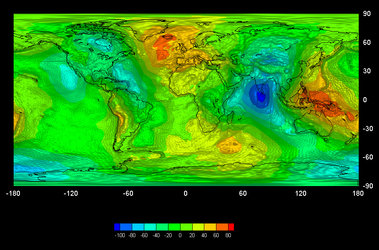
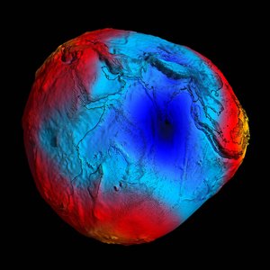
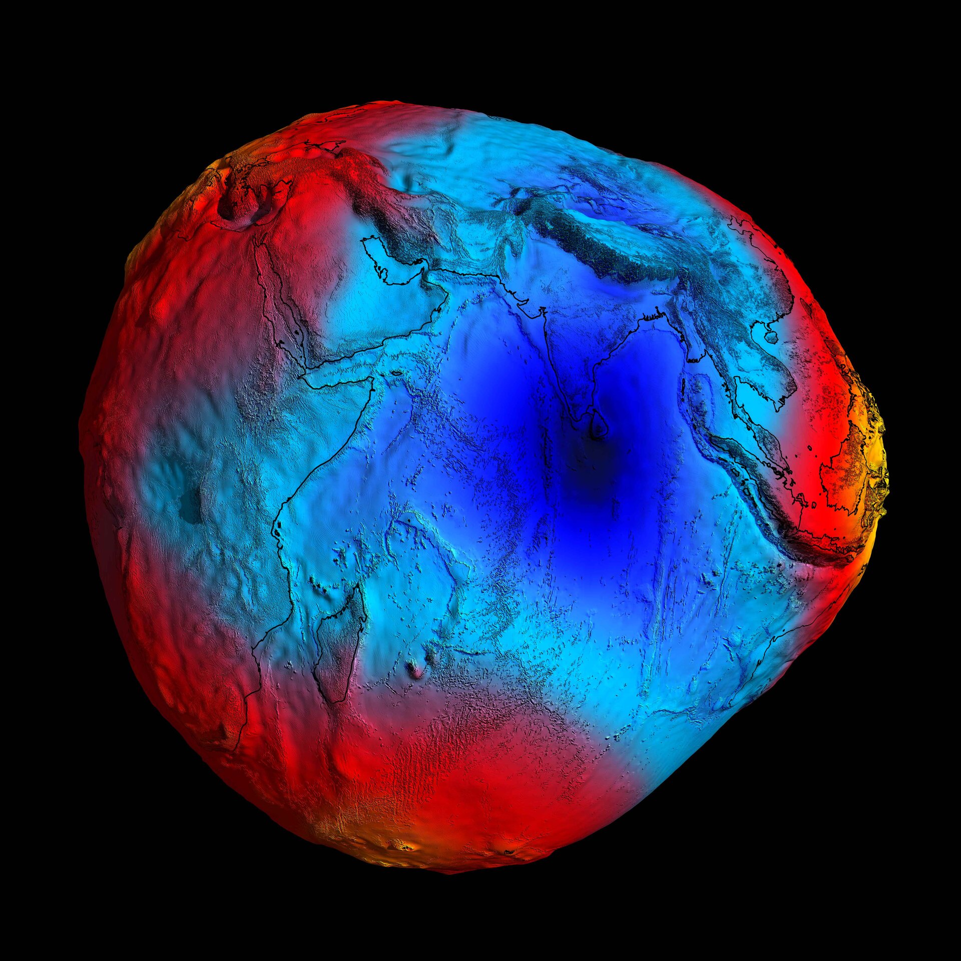
At school we generally learn that g = 9.8 ms–2. Indeed, this value for gravitational acceleration was, for a long time, assumed to be constant for the entire planet. However, as more sophisticated and sensitive tools have been developed, it has become apparent that the force of gravity varies from place to place on Earth's surface.
The standard value of 9.8 ms–2 refers to Earth as a homogeneous sphere. However, in reality, there are many reasons for this value to range from a minimum of 9.78 ms–2 at the equator to a maximum of 9.83 ms–2 at the poles. We can now measure how g varies to more than eight decimal places, but what causes these small but significant changes?
The most significant deviation from the standard value of g is a result of Earth’s rotation. As Earth spins, its shape is slightly flattened into an ellipsoid, so that there is a greater distance between the centre of Earth and the surface at the equator, than the centre of Earth and the surface at the poles. This bigger distance, coupled with the rotation of Earth, results in the force of gravity being weaker at the equator than at the poles.
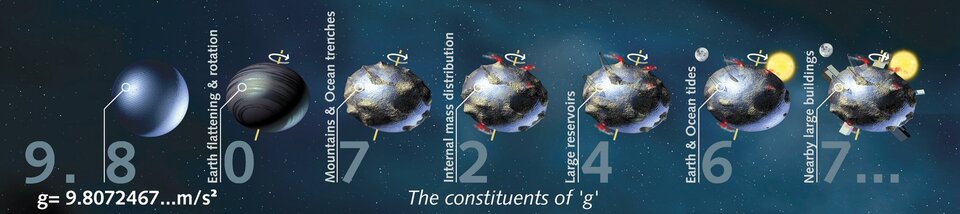
Secondly, the surface of Earth is very uneven; high mountains and deep ocean trenches cause the value of gravity to vary. Thirdly, the materials within Earth’s interior are not uniformly distributed. Not only are the layers within the crust and mantle irregular, but also the mass distribution within the layers is inhomogeneous.
Petroleum and mineral deposits or ground-water reservoirs can also subtly affect the gravity field, as can a rise in sea level or changes in topography such as ice-sheet movement or volcanic eruptions. Even large buildings can have a minor effect. Of course, depending on location, these factors are superimposed upon each other, and can also change with time.
The irregular gravity field shapes a virtual surface at mean sea-level called the 'geoid'.
This is the surface of equal gravitational potential of a hypothetical ocean surface at rest, and so defines 'the horizontal' - meaning that if a ball were placed on this hypothetical surface it would not roll, despite the presence of virtual slopes. The geoid is important for understanding more about ocean currents and is also used as a reference for traditional height systems and monitoring sea-level change. In addition, the geoid is used for levelling and construction.