Lifetime of gravity measurements heralds new beginning
Although ESA’s GOCE satellite is no more, all of the measurements it gathered during its life skirting the fringes of our atmosphere, including the very last as it drifted slowly back to Earth, have been drawn together to offer new opportunities for science.
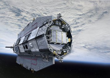
Carrying the first 3D gravity sensor in space, this state-of-the-art satellite measured Earth’s gravity with unprecedented accuracy.
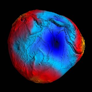
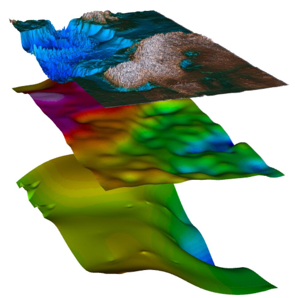
GOCE’s four years in orbit resulted in a series of four gravity models, each more accurate than the last. These models have been used to generate corresponding ‘geoids’ – the surface of a global ocean moulded by gravity alone.
Shaped by differences in gravity, the geoid is a crucial reference for understanding ocean circulation, sea-level change and ice dynamics.

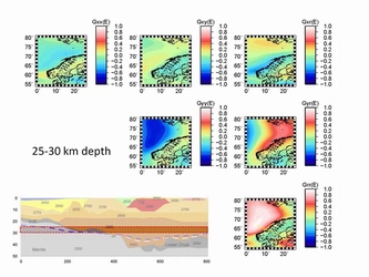
From a mission that just keeps giving, a fifth model has now been produced. It incorporates data collected throughout the satellite’s 42-month operational life.
The previous geoid, released in March 2013, was based on 27 months of measurements.
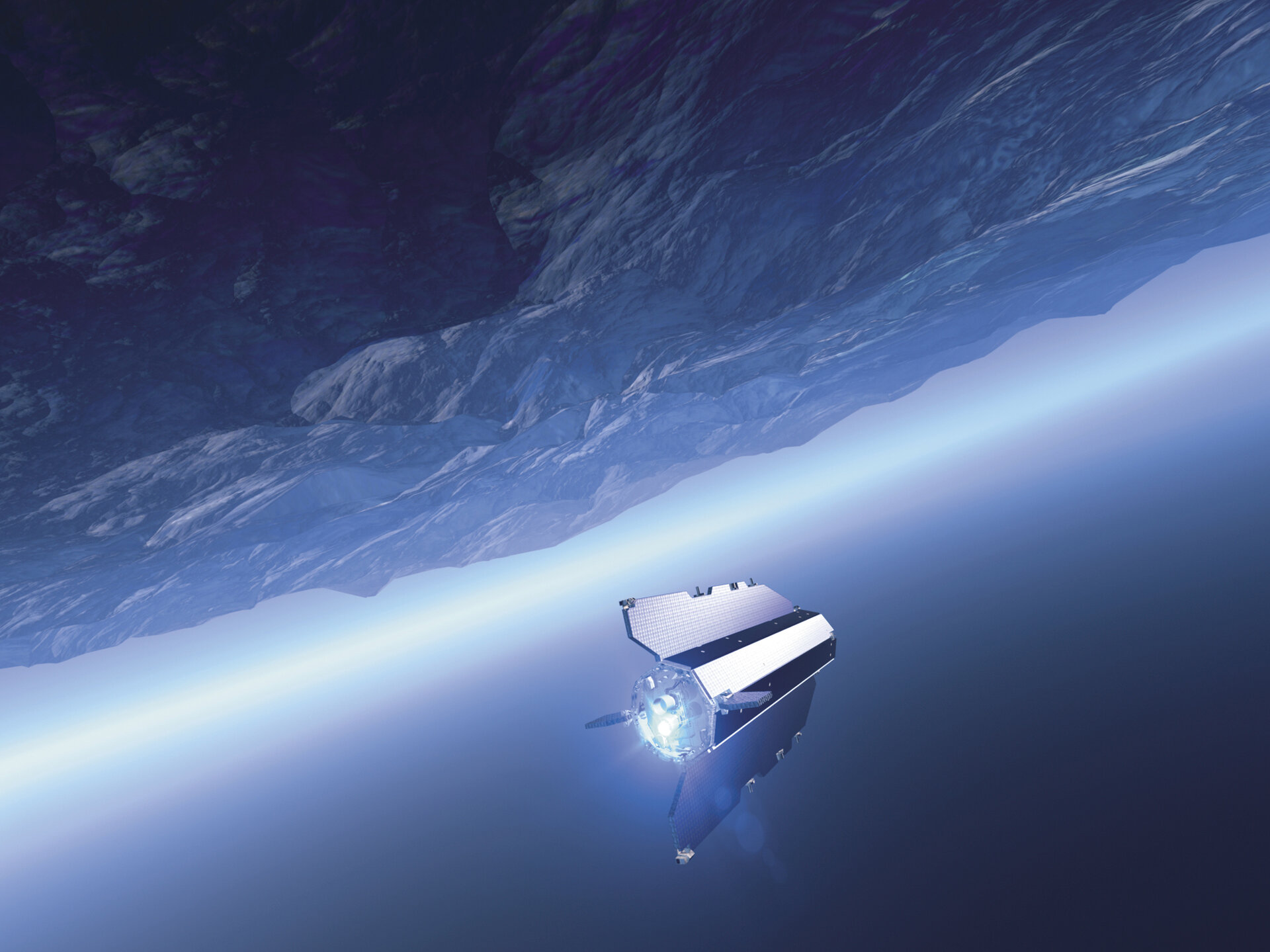
The satellite was designed to orbit at an extremely low altitude of 255 km to gain the best possible gravity measurements. At the end of 2012, low fuel consumption allowed operators to extend its life and start to lower the satellite a further 31 km for even more accurate measurements. This was at the very limit of its capability but maximised the return for science.
After more than doubling its planned life in orbit, the satellite ran out of fuel and drifted back into the atmosphere in November 2013.
The fifth gravity model and geoid, which ESA has recently made available, includes these final precious measurements, right up until the satellite finally stopped working and ironically succumbed to the force it was designed to measure.
Although the satellite is no longer in orbit, scientists now have the best possible information to hand about Earth’s gravity, effectively a new beginning for the mission.
GOCE has already shed new light on different aspects of Earth and surpassed its original scope in a number of ways.
It is being used to understand how oceans carry huge quantities of heat around the planet and to develop a global height reference system.
It has provided information about atmospheric density and winds, mapped the boundary between Earth’s crust and upper mantle, and used to understand what is going on in these layers far below our feet.
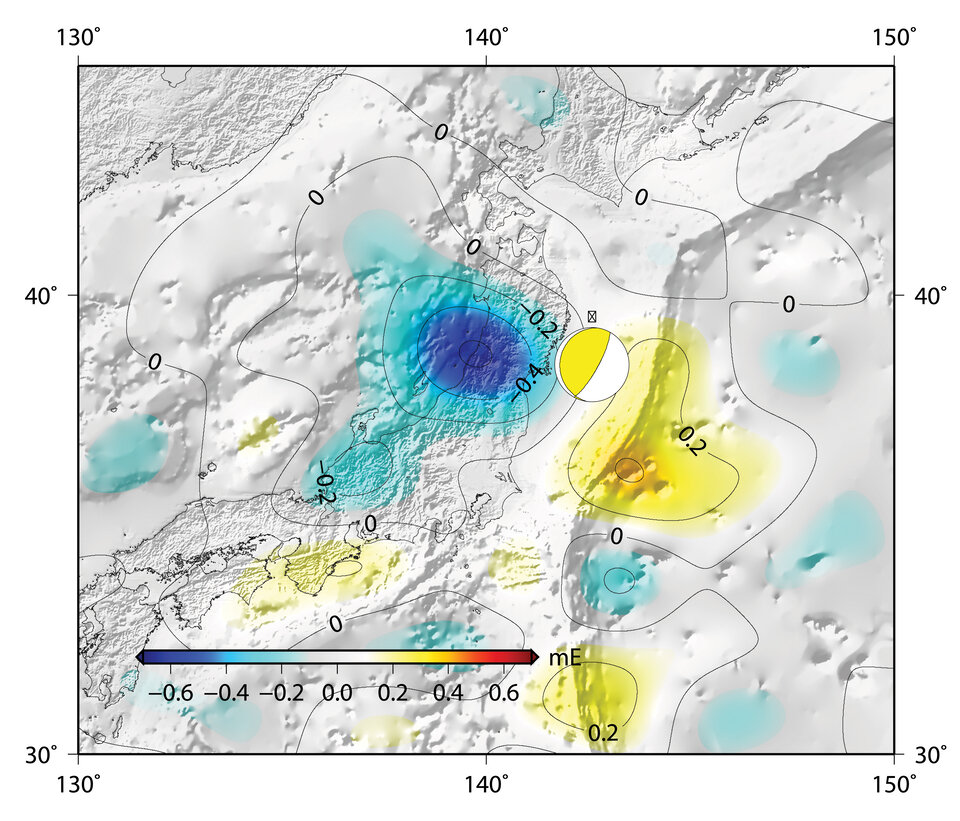
And its achievements include mapping a scar in Earth’s gravity caused by the 2011 Japanese earthquake.
The ultimate geoid model and gravity data will be used for years to come for a deeper understanding of Earth.
ESA’s GOCE Mission Manager, Rune Floberghagen, said, “We are very happy with the results of the final, super-low altitude phase of our mission.
“In fact, efforts made by the mission team and by scientists to secure flight operations at these extreme altitudes and to process the data have resulted in a doubling of the information content and a very significant increase in spatial resolution.
“Indeed, our new ‘Release 5 solutions’ go well beyond the ambitious objectives we had when the GOCE project started.
“Scientists worldwide now have a satellite-based gravity field model at hand that will remain the de facto standard for many years to come.”