New potential for tracking severe storms
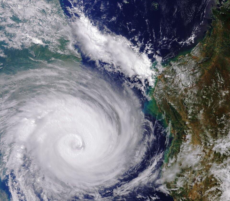
Even just within the last couple of months, Cyclones Fani, Idai and Kenneth have brought devastation to millions. With the frequency and severity of extreme weather like this expected to increase against the backdrop of climate change, it is more important than ever to forecast and track events accurately. And, an ESA satellite is helping with the task in hand.
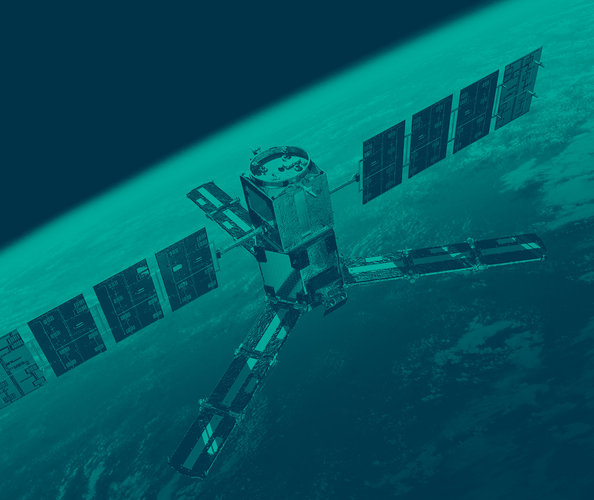
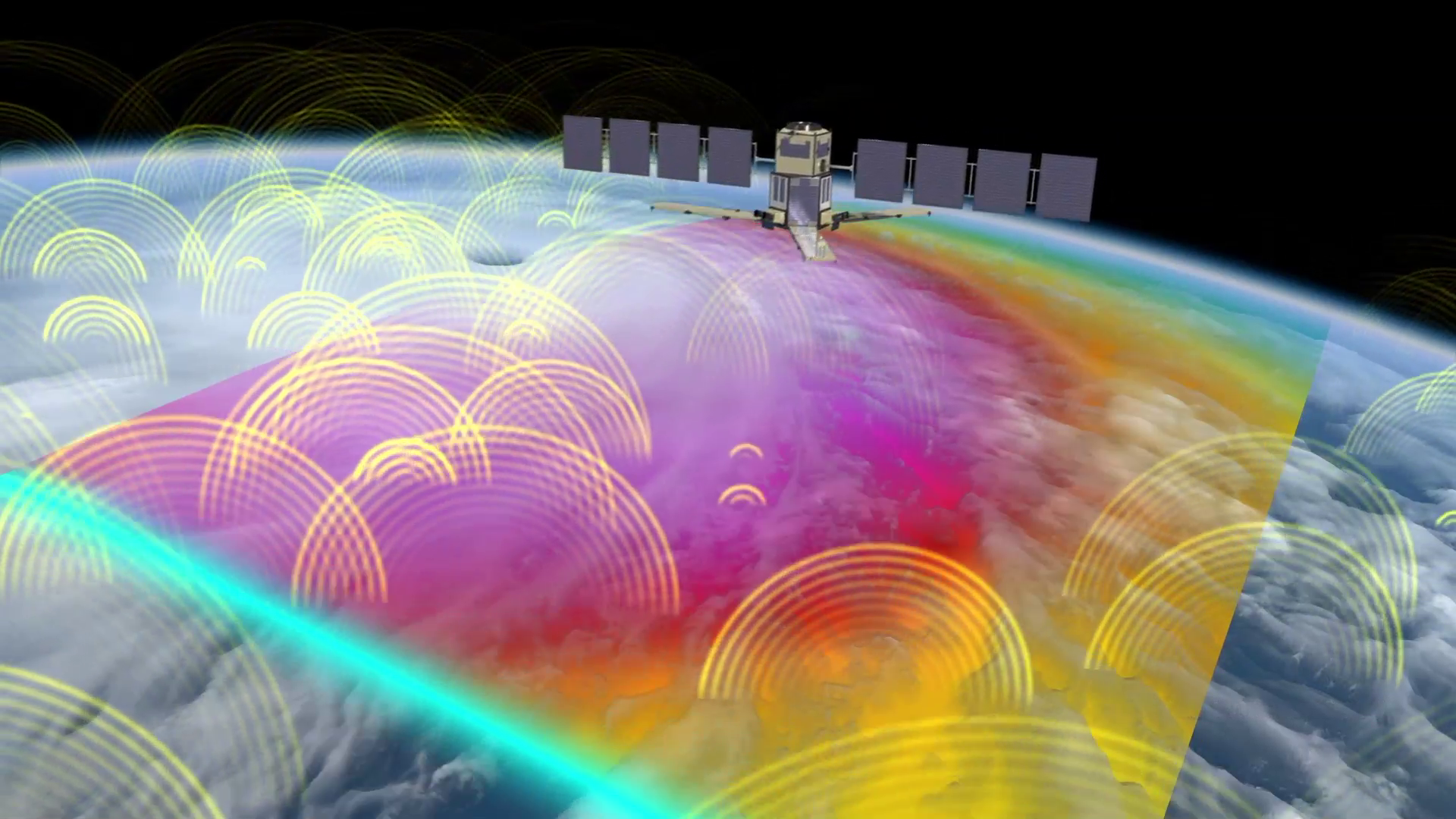
Soon to celebrate 10 years in orbit, SMOS was built to measure soil moisture and ocean salinity to better understand the water cycle. While science benefits from its measurements, the SMOS portfolio is being expanded to help with some everyday applications that include monitoring and improving forecasting of large storms.
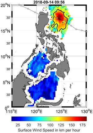
The problem with observing hurricanes and cyclones from space is that satellite’s carrying camera-like instruments cannot see through masses of thick spinning cloud to measure wind speeds.
Traditionally, satellite scatterometer instruments have been the main source of information to measure wind speed over ocean waters, but SMOS can offer additional information when storms are severe.
SMOS carries a microwave radiometer to capture images of brightness temperature. Measurements correspond to radiation emitted from Earth’s surface, which are then used to derive information on soil moisture and ocean salinity.
Strong winds over oceans whip up waves and whitecaps, which, in turn, affect the microwave emission from the surface. This means that the changes in radiation can be linked directly to the strength of the wind over the sea.
Nicolas Reul, from Ifremer, said ”While advances in our understanding of the physics underpinning the life cycle of tropical storms and their development into hurricanes and cyclones is advancing all the time, there is no substitute for improved measurement capability that can help define the character of a given storm.
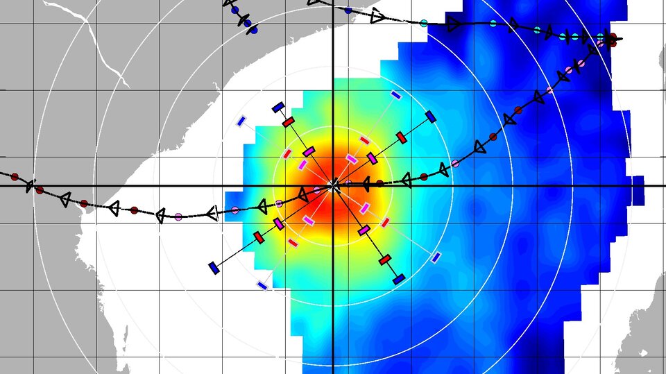
“Although SMOS data have a spatial resolution of 40 km, the wide-swath regular repeat coverage and ability to provide measurements of surface-wind speed structure at hurricane force in the presence of heavy precipitation is unique.”
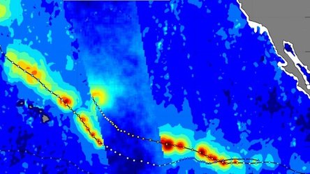
The fact that SMOS can be used to estimate ocean-surface wind speeds in extreme weather has been known for a while – but as highlighted at this week’s Living Planet Symposium, this is being put into practice.
Experiments show that SMOS can, for example, help improve errors in forecast lead times by 36–72 hours in the extratropics.
Working together, ESA, OceanDataLab and Ifremer have started a SMOS wind-data service, which provides near-realtime (3–6 hours from sensing) ocean-surface wind speeds.
Since September 2018, the services has been ‘pre-operational’, providing data to selected users such as the NOAA National Hurricane Center, the U.S. Naval Research Laboratory and the Joint Typhoon Warning Centre who are assessing the potential benefits.
The importance of this goes beyond the SMOS mission as the continuity of these kind of measurements is now being studied within the context of one of six a potential future Copernicus missions.
ESA’s Craig Donlon, explains, “The Copernicus Imaging Microwave Radiometer concept is a global coverage mission, but with a focus on the rapidly changing Arctic region, where both high winds and salinity play a major role in the ocean system.
“There is no doubt that SMOS has allowed us to explore and further develop the enormous potential of L-band microwave radiometer measurements for the ocean.”
We are changing our natural world faster than at any other time in history. Understanding the intricacies of how Earth works as a system and the impact that human activity is having on natural processes are huge environmental challenges. Satellites are vital for taking the pulse of our planet, delivering the information we need to understand and monitor our precious world, and for making decisions to safeguard our future. Earth observation data is also key to a myriad of practical applications to improve everyday life and to boost economies. This week we focus on the world’s biggest conference on Earth observation where thousands of scientists and data users discuss the latest results and look to the future of Earth observation.