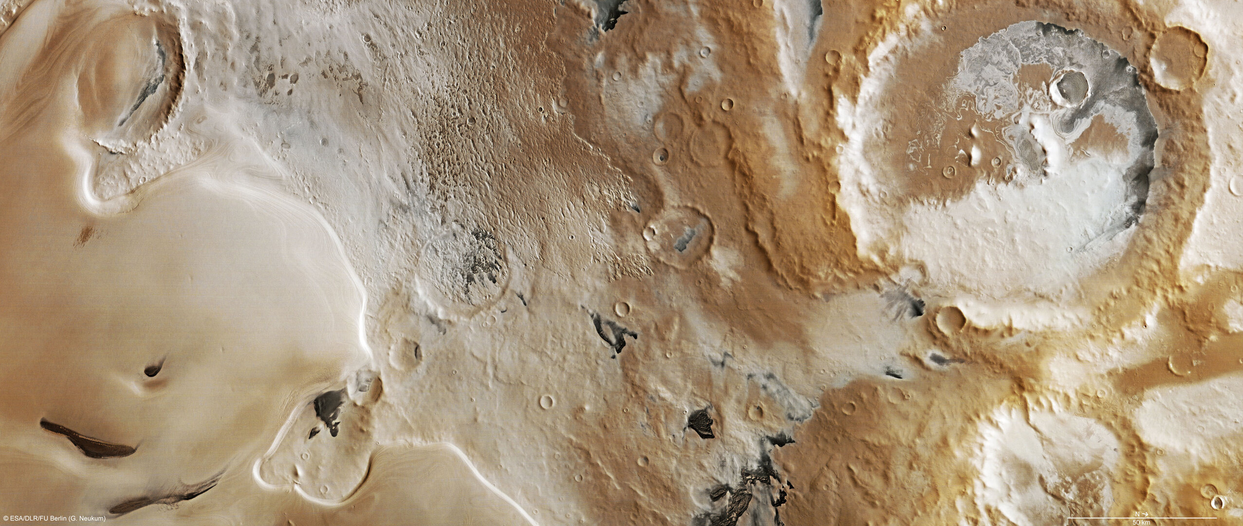
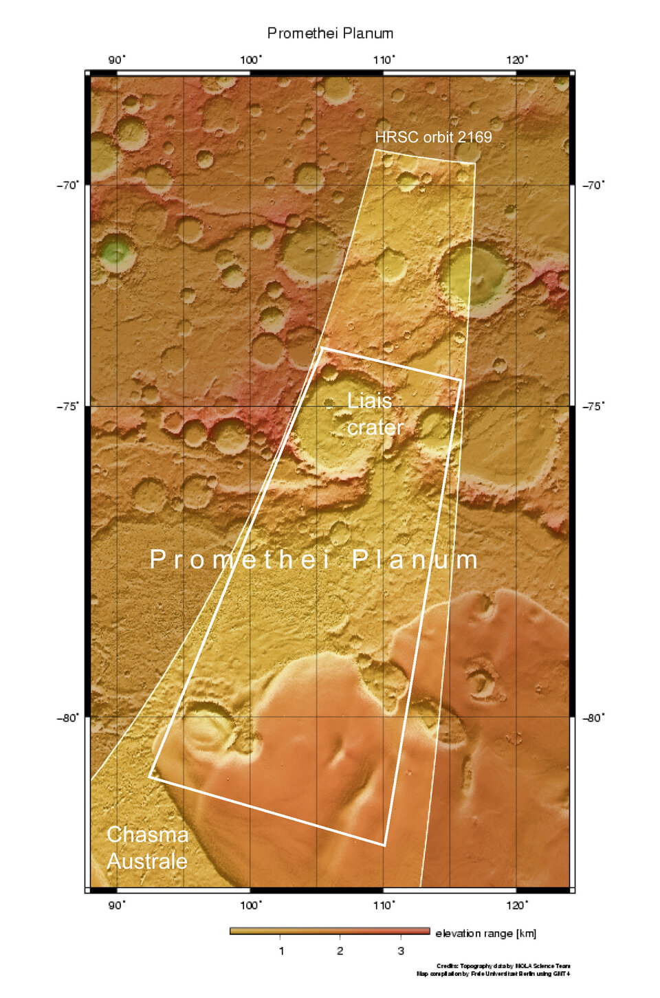
Icy Promethei Planum
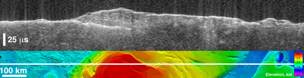
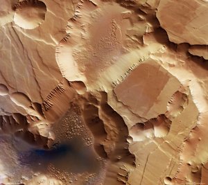
Promethei Planum, an area seasonally covered with a more than 3500 m thick layer of ice in the martian south polar region, was the subject of the High Resolution Stereo Camera’s focus on 22 September 2005 as Mars Express was in orbit above the Red Planet.
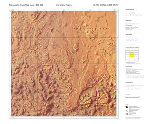
Promethei Planum lies at approximately 76° south and 105° east on the Red Planet. The image data acquired in the region has a ground resolution of approximately 40 m/pixel.
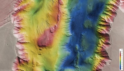
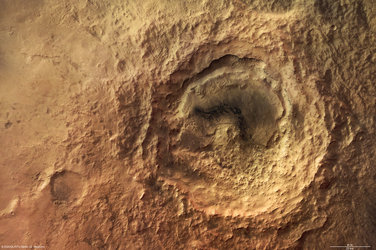
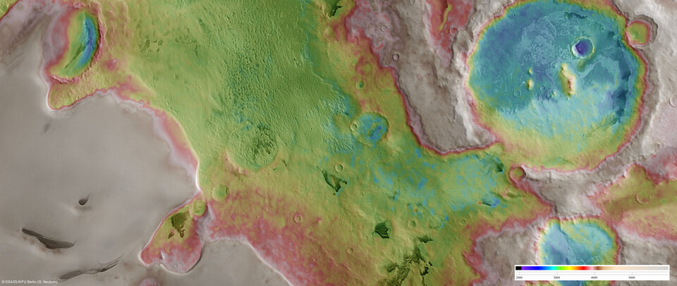
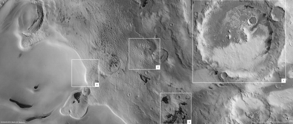
An impact crater that is approximately 100 km wide and 800 m deep is visible in the northern part of the image. The crater’s interior is partly covered in ice.
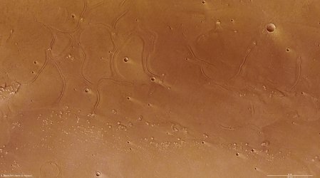
In the centre of the image are structures that may have been created by basaltic lava flow from a volcano. This area is covered in ice. The dark dunes towards the bottom of the image are most likely made up of dust originating from this lava flow or volcanic ash.
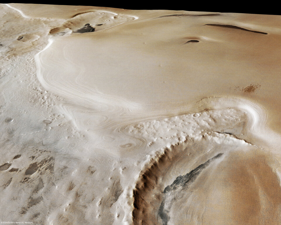
A broad sheet of ice, which is an extension of the south polar ice cap is located south of the lava flow, to the left in the (nadir) image. The steep flanks clearly show white, clean ice. The thickness of the ice is between 900 and
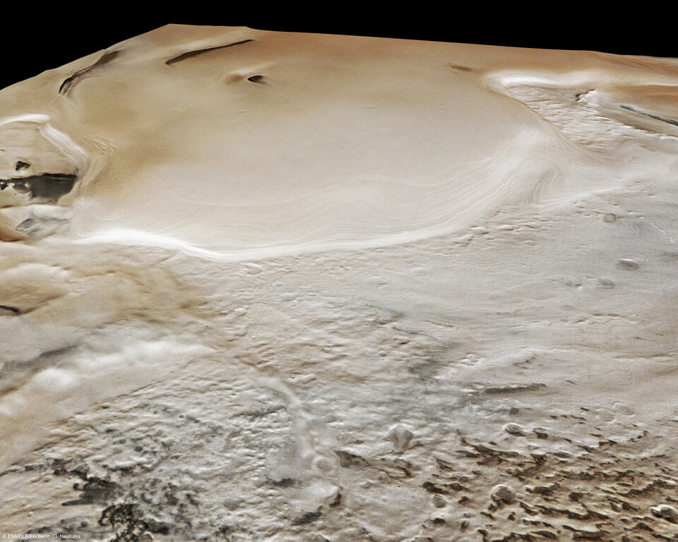
Latest results from the Mars Advanced Radar for Ionosphere and Subsurface Sounding (MARSIS) onboard Mars Express have revealed that the thickness of this extension of the south polar ice cap exceeds 3500 m. The total amount of water ice contained at both the south and north poles of Mars makes up the largest water reservoir on the planet today.
If polar ice melted, the entire surface of the planet would be covered by an ocean 11-m deep.
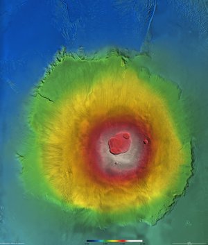
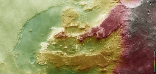
The colour scenes have been derived from the three High Resolution Stereo Camera (HRSC) colour channels and the nadir channel. The perspective views have been calculated from the digital terrain model derived from the stereo channels.
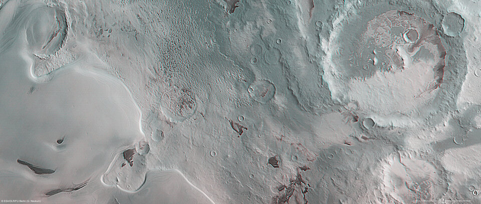
The anaglyph image was calculated from the nadir and one stereo channel, stereoscopic glasses are required to view it.
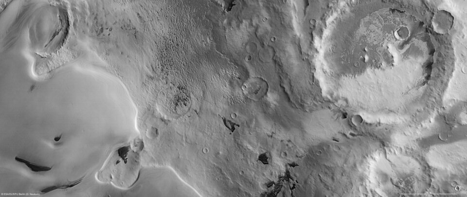
The black and white high resolution images were derived form the nadir channel which provides the highest detail of all channels.
For more information on Mars Express HRSC images, please read our updated FAQ (frequently asked questions).