
Sand dunes meet stacked ice at Mars’s north pole
ESA’s Mars Express has captured an intriguing view near Mars’s north pole, imaging where vast sand dunes meet the many layers of dusty ice covering the planet’s pole.
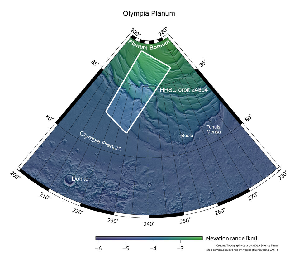
The terrain surrounding Mars’s north pole, known as Planum Boreum, is fascinating. The pole itself is covered in layers and layers of fine dust and water ice; these stack several kilometres thick and stretch out for around 1000 km (approximately the width of France).
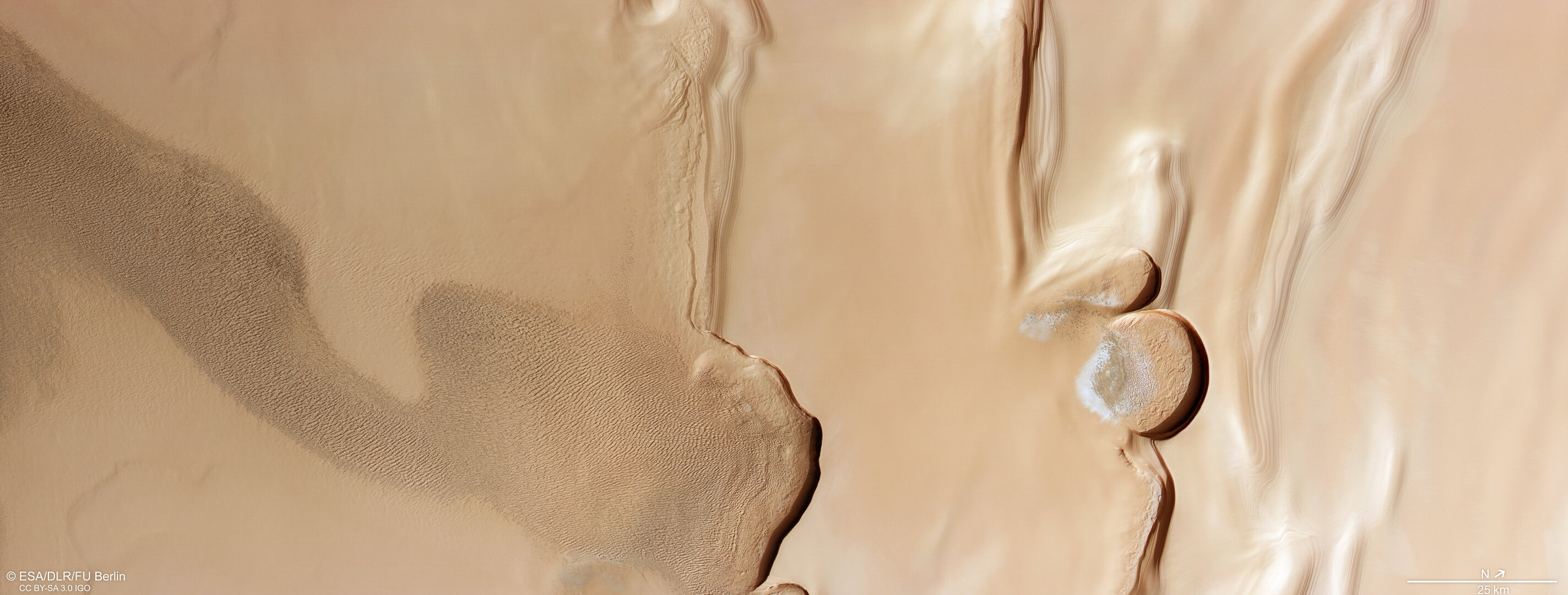
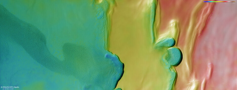
While most of this material is not visible here, you can see the beginnings of Planum Boreum to the right of the frame, with some subtle wrinkling showing where layers of material are starting to build up. Ground has also built up more starkly in steps, as is most clearly visible in the topographic view of this region below. The lowest altitude regions are blue/green and the highest are red/white/brown.
These layers formed as a mix of dust, water ice and frost settled on the martian ground over time. Each layer holds valuable information about Mars’s history, telling the story of how the planet’s climate has changed over the past few million years.
In martian winter, the layers are topped by a thin cap of dry ice (carbon dioxide ice) a couple of metres thick. This cap completely disappears to the atmosphere each martian summer.
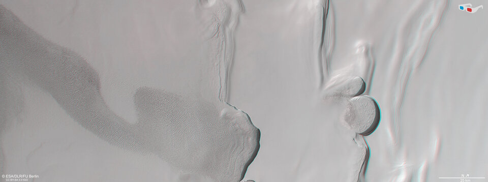
This image comes from the Mars Express High Resolution Stereo Camera (HRSC). Two steep banks, or escarpments, cut vertically through the frame. These mark the boundary between the aforementioned layered deposits (which stretch out of frame towards the pole, right) and the vast, sweeping dune fields covering the lower terrain of Olympia Planum (to the left).
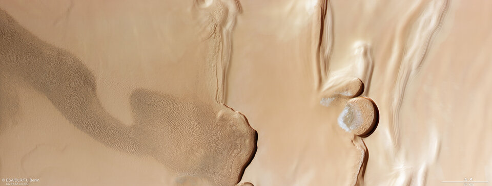
Click on the image below to explore the region and discover more about the different features you can see.
Walls of ice
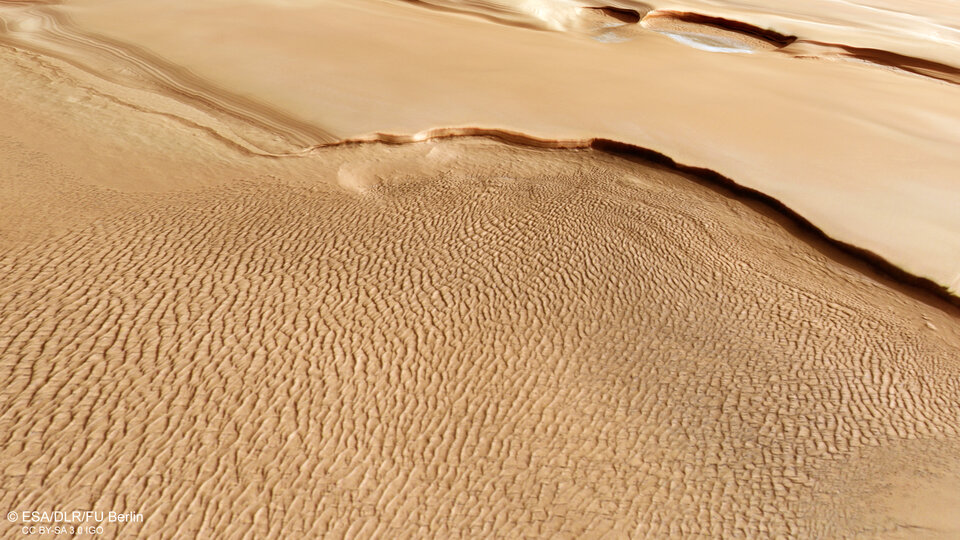
The left part of this image is dominated by a vast, elongated swathe of rippled sand dunes, stretching out for more than 150 km within this frame alone. This wrinkled, turbulent appearance is highly at odds with the smooth and more pristine terrain visible to the right.
This smooth region lacks clear signs of erosion and has avoided being hit by incoming rocks from space – an indicator that the surface is very young, likely rejuvenating every year.
Between these two extremes sit two semicircular cliffs, the larger of which is around 20 km wide. Within the curves of these cliffs sit frost-covered sand dunes. The grand scale of the cliffs is clear from the dark shadows they cast on the surface below – their steep, icy walls tower up to a kilometre high.
These two cliffs are located at a so-called polar trough, a feature created as wind pushes into and wears away the surface. These show up as rippled ridges in the terrain and are common in this region, creating the distinctive spiral-like pattern of the polar plateau (seen most clearly in the wider context view of this region below, and in other images of Planum Boreum from Mars Express).
Exploring Mars
Mars Express has been orbiting the Red Planet since 2003. It is imaging Mars’s surface, mapping its minerals, identifying the composition and circulation of its tenuous atmosphere, probing beneath its crust, and exploring how various phenomena interact in the martian environment.
The spacecraft’s HRSC, responsible for these images, has revealed much about Mars’s diverse surface in the past 20 years. Its images show everything from wind-sculpted ridges and grooves to sinkholes on the flanks of colossal volcanoes to impact craters, tectonic faults, river channels and ancient lava pools. The mission has been immensely productive over its lifetime, creating a far fuller and more accurate understanding of our planetary neighbour than ever before.
The Mars Express High Resolution Stereo Camera (HRSC) was developed and is operated by the German Aerospace Center (Deutsches Zentrum für Luft- und Raumfahrt; DLR).